File:1863 Johnson's Map of Colorado, Dakota, Idaho, Nebraska ^ Kansas - Geographicus - COCANE-j-64.jpg
Jump to navigation
Jump to search
Size of this preview: 743 × 599 pixels. Other resolutions: 298 × 240 pixels | 595 × 480 pixels | 952 × 768 pixels | 1,269 × 1,024 pixels | 2,538 × 2,048 pixels | 3,500 × 2,824 pixels.
Original file (3,500 × 2,824 pixels, file size: 2.8 MB, MIME type: image/jpeg)
Captions
Captions
Add a one-line explanation of what this file represents
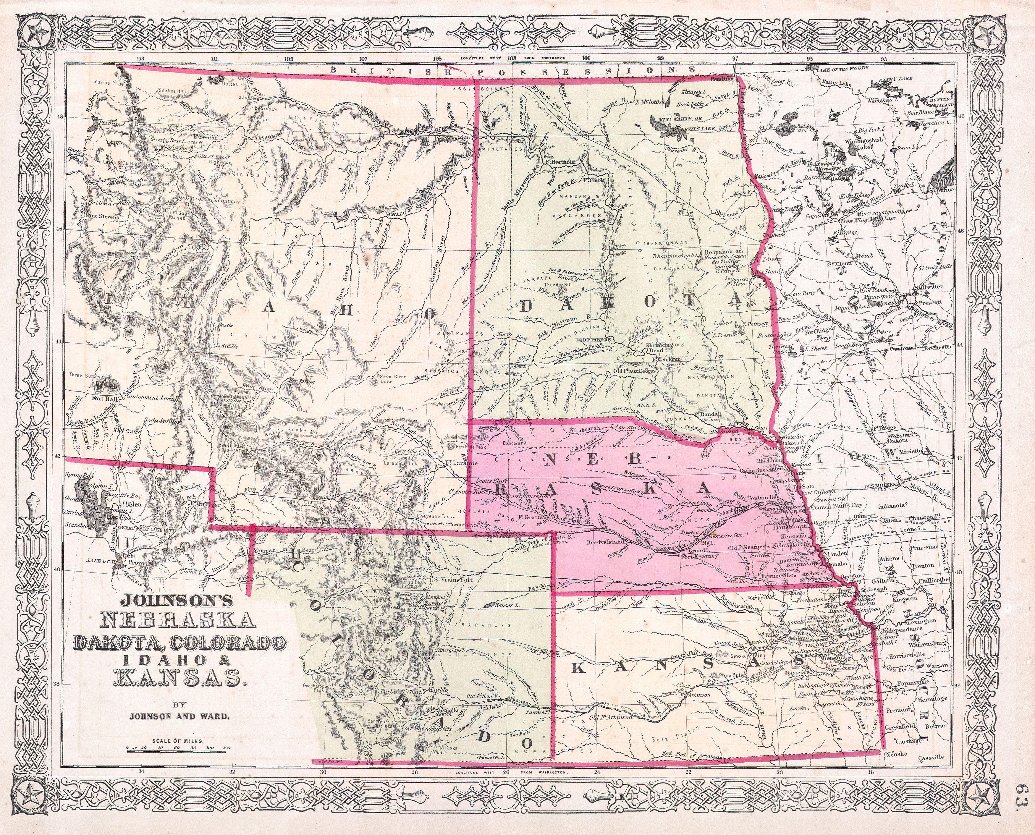
| Alvin Jewett Johnson: Johnson’s Nebraska Dakota, Colorado, Idaho & Kansas.
( |
|||||||||||||||||||||||
|---|---|---|---|---|---|---|---|---|---|---|---|---|---|---|---|---|---|---|---|---|---|---|---|
| Artist |
|
||||||||||||||||||||||
| Title |
Johnson’s Nebraska Dakota, Colorado, Idaho & Kansas. |
||||||||||||||||||||||
| Description |
English: This is a beautifully hand colored 1863 lithograph map of what today consists of the states of Idaho, Wyoming, Colorado, Montana, North Dakota, South Dakota, Nebraska and Kansas. Extends west as far as the Great Salt Lake and east to Lake Superior. Large Idaho Territory predates the creation of Wyoming and Montana. The newly created territory of Colorado (1861) appears in the lower left. Crisscrossed throughout with wagon trails, explorer’s routes, railroads, and proposed railroads. Also offers superb detail regarding the deportment of area American Indian tribes and settlements. An important phase of the Johnson Mountain States map series. Cartographically this map is based upon the earlier work of J. H. Colton. Page no. 63 in the 1863 edition of Johnson’s Family Atlas. |
||||||||||||||||||||||
| Date | 1863 | ||||||||||||||||||||||
| Dimensions | height: 13 in (33 cm); width: 16.5 in (41.9 cm) | ||||||||||||||||||||||
| Accession number |
Geographicus link: COCANE-j-64 |
||||||||||||||||||||||
| Source/Photographer |
|
||||||||||||||||||||||
| Permission (Reusing this file) |
|
||||||||||||||||||||||
File history
Click on a date/time to view the file as it appeared at that time.
| Date/Time | Thumbnail | Dimensions | User | Comment | |
|---|---|---|---|---|---|
| current | 03:00, 25 March 2011 | | 3,500 × 2,824 (2.8 MB) | BotMultichillT (talk | contribs) | {{subst:User:Multichill/Geographicus |link=http://www.geographicus.com/P/AntiqueMap/COCANE-j-64 |product_name=1863 Johnson's Map of Colorado, Dakota, Idaho, Nebraska & Kansas |map_title=Johnson’s Nebraska Dakota, Colorado, Idaho & Kansas. |description |
You cannot overwrite this file.
File usage on Commons
The following page uses this file: